

Storm Goretti Will Bring Even More Fresh Snow to the Netherlands
Storm Goretti brings fresh snow, strong winds, and drifting “snow dunes” into a country already dealing with ice, and disruption is likely to continue into the weekend.

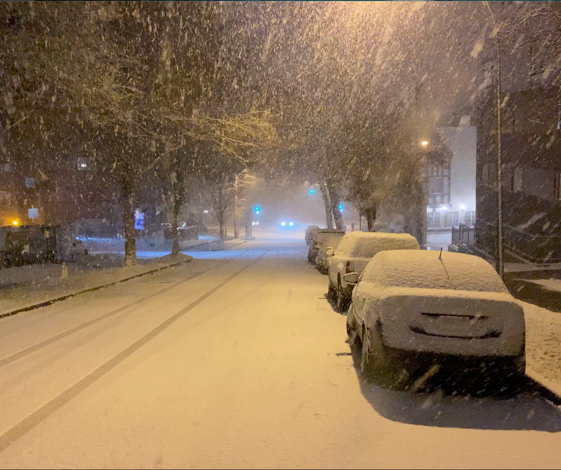

A powerful depression, named Storm Goretti, is moving toward the Netherlands and is expected to bring another round of snow on top of the snow and ice that already disrupted travel earlier this week. Meteorologists say the main concern is not just the amount of snowfall, but the combination of snow and strong winds, which can lead to drifting snow, poor visibility, and the formation of so-called snow dunes on roads, rail lines, and open areas.
Because the ground is already frozen and many surfaces still hold compacted snow, even a relatively short-lived snow event could have massive consequences.
Warnings expand, with the north at highest risk
The national meteorological institute has expanded weather warnings as Storm Goretti approaches. The north is repeatedly highlighted as the most vulnerable region.
For Groningen, an orange warning is in effect due to slippery roads caused by 5–10 centimetres of snow, combined with strong wind that can create snow drifts and snow dunes. Authorities warn of serious disruption to road, rail, and air transport.
In North Holland, a yellow warning remains in place for snow and ice. Forecasters warn that snow combined with wind may rapidly worsen road conditions, particularly on exposed roads, bridges, and coastal routes.
Warnings are being reviewed continuously because even modest snowfall can cause major problems when temperatures drop below freezing overnight and meltwater refreezes.
How much snow is expected, and where
Forecast models differ slightly, but the overall picture is clear: the north is likely to receive the heaviest snow, while central and western regions may see a mix of snow, sleet, and rain.
In the most intense part of the depression, snowfall could reach up to 15 centimetres in northern areas, though totals will vary sharply depending on wind direction and local conditions.
Short-term forecasts show:
Amsterdam: periods of snow and rain on Friday, followed by intermittent snow and flurries on Saturday, with 1–2 cm of accumulation possible
Groningen: rain turning to snow on Friday, with 1–3 cm initially, followed by a much colder Saturday night
Even light snow becomes dangerous when compacted into ice or blown into snow dunes that suddenly block lanes or reduce visibility.
Why snow dunes and drifting snow are a major concern
Storm Goretti brings not only snow, but also strong winds, which prevent snow from settling evenly. Instead, snow is blown into piles and ridges (commonly described as snow dunes) especially in open landscapes.
These snow dunes can:
reappear quickly after roads are cleared
create sudden slippery patches
reduce visibility without warning
make motorways and provincial roads unpredictable
In flat, open regions of the Netherlands, drifting snow can undo hours of clearing work within minutes.
Transport disruption is likely to continue
The disruption earlier this week already affected trains, flights, and roads at the same time. The arrival of a new depression means problems are likely to continue, especially as transport systems are still recovering from earlier delays.
Rail operators warn that snow and ice can cause frozen switches, slower speeds, and cascading delays. In aviation, snowfall puts pressure on de-icing capacity, while on roads, accident risk rises sharply when daytime melting is followed by evening refreezing.
Authorities stress that the end of a higher warning level does not mean conditions are safe: residual snow, ice, and drifting snow can remain dangerous for days.
Everyday services may be disrupted again
When roads become unsafe, disruption spreads beyond commuting:
Waste collection and municipal services may be paused because heavy vehicles struggle on icy residential streets
Supermarket deliveries can be delayed, leading to temporary shortages of fresh products
Events and activities may be cancelled if safe access cannot be guaranteed
These impacts vary by region, depending on snowfall intensity, wind exposure, and how quickly surfaces refreeze.
How long will wintry conditions last
The most intense phase of Storm Goretti is expected from Friday into Saturday, but winter risks will persist beyond that.
Forecasts show sub-zero nights over the weekend in both the west and north. In Groningen, temperatures could drop to around -11°C, keeping snow and ice on the ground and making untreated surfaces hazardous.
From early next week, a transition toward milder, wetter weather is expected. While this may reduce snowfall, it could also create a messy phase of melting snow, slush, and overnight refreezing.
What people should watch for
With a new depression arriving while the country is already under winter strain, key risks include:
rapidly changing road conditions
drifting snow and snow dunes in open areas
refreezing at night leading to black ice
renewed disruption to transport and services
For now, forecasters warn that the north faces the greatest impact, while the rest of the Netherlands should prepare for slippery conditions and continued disruption as Storm Goretti moves through the region.