

Relief After Heatwave, Hail and Wind Expected on Saturday Evening in The Netherlands
After a record-breaking heatwave, severe thunderstorms with hail and strong wind are expected across the Netherlands on Saturday evening, bringing relief and much cooler weather from Monday.

See more of Dutch Brief in your Google search results
After a stretch of extreme heat, relief is finally in sight for the Netherlands, though it is likely to arrive with a bang. Severe thunderstorms are expected to sweep the country on Saturday evening, breaking the heatwave and ushering in much cooler weather.
A record-breaking few days
The heat reached its peak on Friday, which was the warmest 26 June ever measured in the Netherlands. The highest temperature, 39.4°C, was recorded in Ell, in Limburg, while it reached 36.6°C at the De Bilt weather station, the warmest June day recorded there, and 38.2°C in Eindhoven, also a local record. It was the first time the KNMI had issued code rood, its heaviest warning, because of heat.
The national record of 40.7°C, set in Gilze-Rijen in July 2019, was not broken. Across the border, however, Germany set a new national record of 41.3°C at the Saarbrücken-Burbach station, just above its previous high. The nights offered little respite either, with temperatures in many places staying above 20°C, what meteorologists call a tropical night.
Saturday remains very warm, with highs of 33 to 38°C, and code red for heat still in force in the southeast until the evening, before the change arrives.
All the ingredients for severe storms
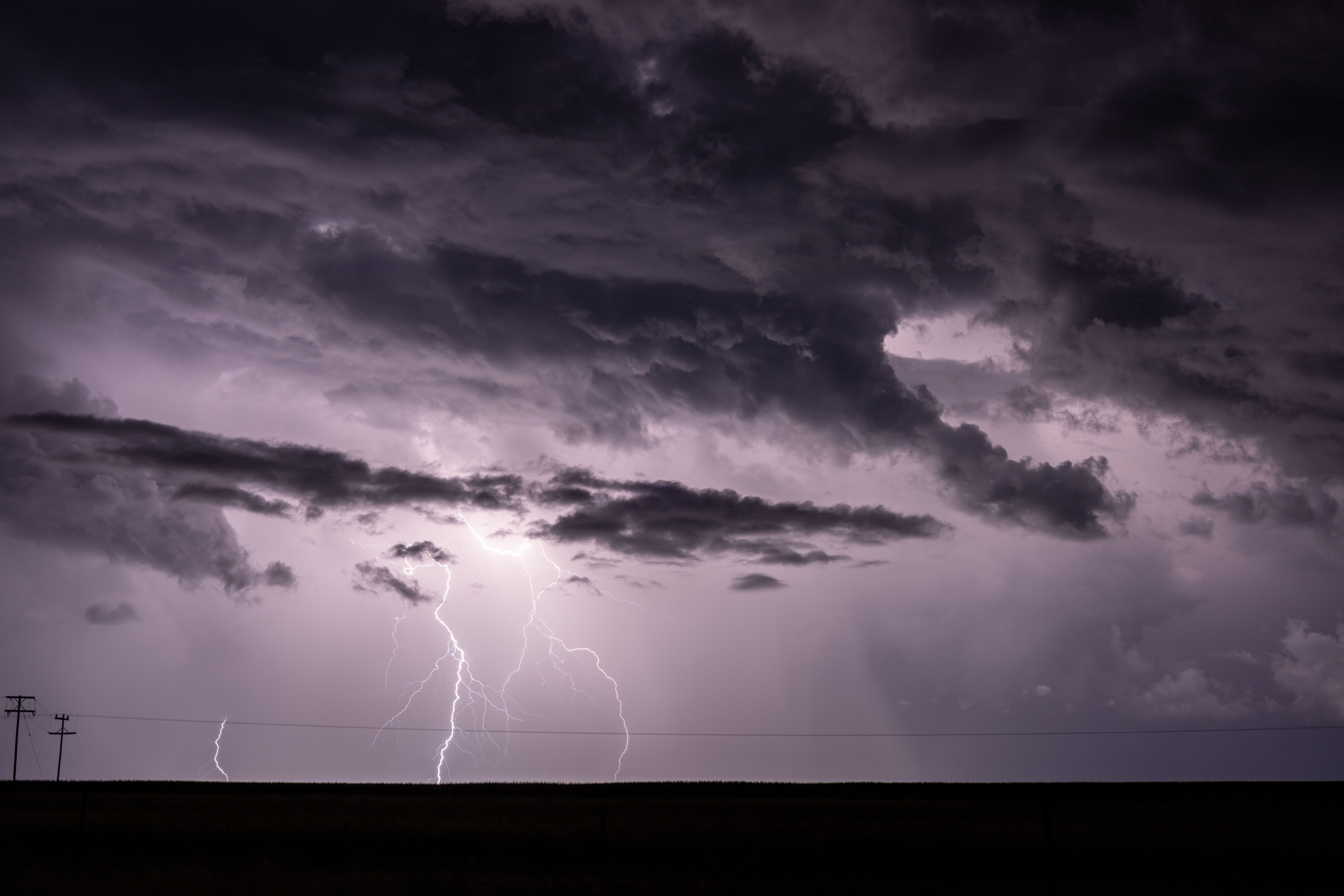
According to a meteorologist quoted by AD, all the ingredients are in place for heavy thunderstorms late on Saturday evening. The KNMI has issued code geel (a yellow warning) for the whole country for the evening, when severe storms could bring hailstones of 2 to 5 centimetres, wind gusts of 75 to 100 km/h and a lot of rain in a short time, enough to cause local damage and disruption.
Forecasters say the storms could be intense. The KNMI warns of a real chance of an organised line of storms with an embedded supercell, the most powerful type of thunderstorm, in which the rising air rotates. Its spokesperson Jan Rozema said the likelihood across the whole country was considerable, and that the storms could be worse than those of the previous week, which had caused damage and, in one case, a death.
SPONSORED
You’re overpaying your accountant. And they still don’t call you back.

Neno gives you a dedicated bookkeeper, automated admin, real-time financial insights and a free business bank account. Everything your business needs, in one place.
No chasing. No surprises. No unnecessary costs.
Cooler weather on the way
The storms come with a cold front that gradually cools the country. Temperatures will start to drop on Sunday, when there is still a chance of thunderstorms, mainly in the southeast, and the change becomes clearer from Monday, when it turns much less warm. The KNMI expects more changeable weather to follow, with a mix of sun, cloud and the occasional shower, and temperatures closer to normal for the time of year.
A heatwave shaped by climate change
Scientists have linked the extreme heat to a changing climate. According to an analysis by the international World Weather Attribution network, with input from the KNMI, a June heatwave on this scale across Europe would have been almost impossible without climate change. KNMI climate scientist Sjoukje Philip said the contrast with the major heatwave of 2003 was striking, and that warm nights now occur around a hundred times more often than they did then.
That matters for health, she noted, because the body needs to cool down after a hot day, and several tropical nights in a row make that difficult, especially for older and unwell people. The public health institute RIVM kept its National Heat Plan in force through the weekend and also warned of smog, with poor air quality possible in parts of the centre and northwest, advising sensitive people to stay indoors and limit exertion in the late afternoon.
Staying safe in the storms
With heavy storms forecast, the advice is to take simple precautions: secure loose items in gardens and on balconies, avoid sheltering under trees, and take account of possible disruption to traffic and outdoor plans. After a tiring week of heat, the cooler days ahead will be welcome for many.